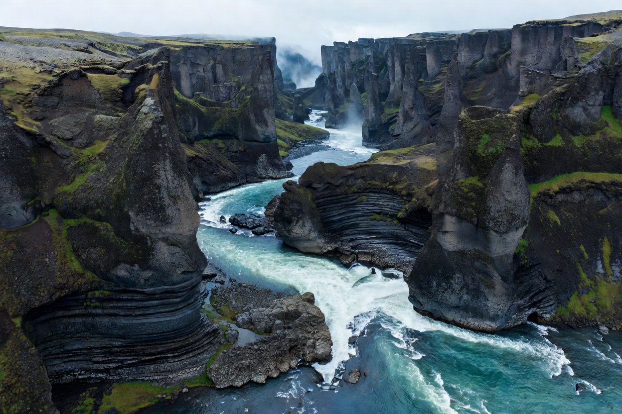
Regional Disparity in Water Systems
Iceland’s waterfalls are not uniform features. Their flow rate, sediment load, height, and approach trails are dictated by regional tectonic boundaries and glacial proximity.
The island divides into four distinct hydrological sectors: the coastal cliff lines of the South, the volcanic fault gorges of the North, the tiered basalt traps of the Westfjords, and the deeply incised hanging valleys of the East.
1. The Southern Coastal Corridor
The southern margin between Seljalandsfoss and Kirkjubæjarklaustur features waterfalls dropping over ancient sea cliffs. When the last ice sheet receded, isostatic rebound elevated the former coastline, leaving hanging river channels that plunge 60 to 120 meters directly onto alluvial sand plains.
Accessibility here is the highest in the country. Route 1 runs directly parallel to the rock wall. Trail access from car parks averages 200 to 800 meters over flat gravel or stabilized timber boardwalks.
Key risk factor: Heavy marine moisture from the Atlantic combines with glacial spray, producing constant surface slickness even during dry summer days.
2. The Northern Rift Gorges
In the north, waterfalls inhabit tectonic rift fissures within volcanic plateaus. The river Jökulsá á Fjöllum drains northern meltwater from the Vatnajökull ice cap through catastrophic flood canyons.
Waterfalls here carry enormous quantities of abrasive glacial silt. Flow rates are the highest in Europe by volume. Surfaces are raw volcanic breccia, loose columnar basalt, and unshielded rock rims without security cables.
Access requires unpaved roads (such as Route 864 and Route 862). Route 864 consists of heavy washboard gravel subject to seasonal washouts, while Route 862 provides paved access to specific western viewpoints.
3. The Westfjords Amphitheaters
The Westfjords represent Iceland’s oldest basalt bedrock, formed over 14 million years ago. Repeated glacial carving has created stepped fjord walls where streams cascade across consecutive horizontal basalt lava flows.
Dynjandi serves as the regional benchmark. It drops 100 meters across tiered steps that widen from 30 meters at the crest to 60 meters at the base.
Access requires traversing steep mountain passes. Heavy winter snowfall isolates these routes between late October and late May. Walking surfaces consist of unpaved stone steps built over mossy scree slopes.
4. The Eastern Fjords and Highlands
Eastern waterfalls are defined by long glacial troughs, remote gravel tracks, and solitary cascades feeding narrow fjord heads. Many sites require traversing unmaintained sheep tracks through waterlogged peat bogs.
Wind funneling down narrow fjord walls can exceed 35 meters per second during autumn storms, blowing falling water entirely horizontal or upward back over canyon rims.
| Sector | Primary Geology | Runoff Source | Standard Access |
|---|---|---|---|
| South Shore | Former Sea Cliffs / Hyaloclastite | Mýrdalsjökull / Eyjafjallajökull | Paved Route 1; high foot traffic |
| North Gorge | Tectonic Rift Basalt / Chasm Faults | Vatnajökull Glacial Drainage | Route 862/864; gravel buffers needed |
| Westfjords | Tiered Tertiary Basalt Traps | Spring Snowpack & Plateau Lakes | Mountain passes; closed in mid-winter |
| Eastfjords | Glacial Valleys & Rhyolite Veins | Seasonal Snow & Moorland Runoff | Secondary spurs; loose scree tracks |
GOOD FOR
- Selecting appropriate vehicle classes (2WD paved vs high-clearance 4WD for northern gravel).
- Budgeting transit times between geological zones.
- Choosing terrain that matches hiker mobility and footwear capability.
WHAT TO KNOW
- Regional access can change rapidly. Road authorities close interior spurs without notice during spring thaw.
- Never assume cell coverage remains active deep in northern and eastern basalt canyons.
- Verify local road condition reports before departing regional service hubs.
Need regional terrain feedback? Submit inquiries regarding route passability and track conditions through our field desk.
CONTACT FIELD DESK